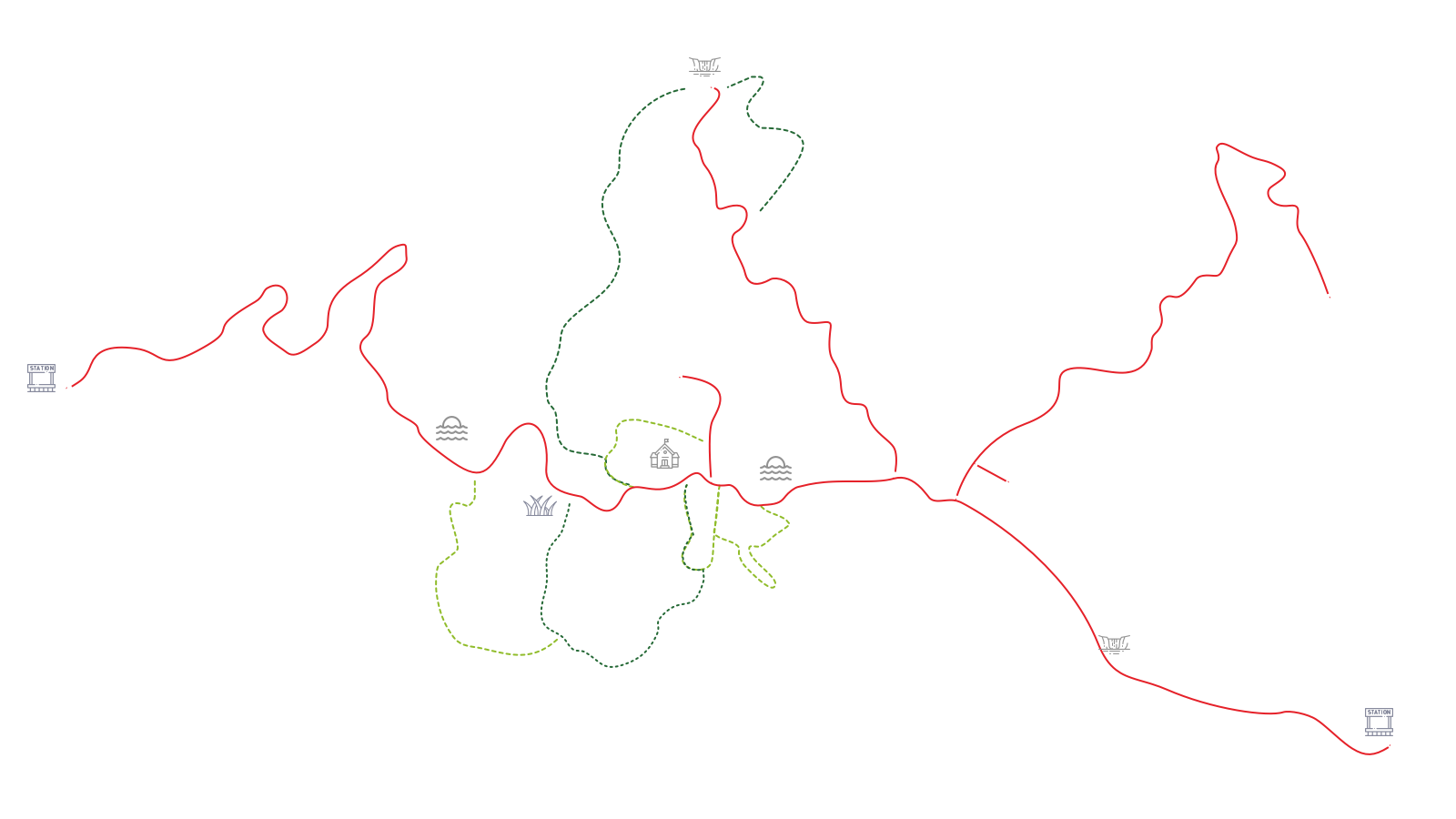
Trekking nature trails
Trek along
7
Nature Trails

Visitor Center – Kong Kaew Waterfall
Distance: 1.2 km – One-way circular trail returning to the start point
Estimated time to trek: 45 mins - 1 hour
Trail guide : Not necessary
Start point: Hanging bridge behind the Visitor Center
End point: Hanging bridge behind the Visitor Center at the National Park Office
Pha Kluai Mai Campground – Haew Suwat Waterfall
Distance: 3 km one-way trail
Time taken: 2 hours
Trail guide : Not necessary
Start point: Pha Kluai Mai Campground
End point: Haew Suwat Waterfall
Km. 33 – Nong Phak Chi
Distance: 4.2 km one-way trail
Time taken: 2.5 - 3 hours
Trail guide: Mandated
Start point: At the roadside by the Km. 33 milestone
End point: At the roadside by the Km. 35 milestone, about 1 km from the Observation Tower
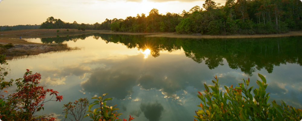
Dong Tiw – Sai Sorn Reservoir
Distance: 2.7 km. one-way trail
Time taken 1.5 - 2 hours
Trail guide: Mandated
Start point: At the side of Thanarat Road about 200m from the Visitor Center at Sai Sorn Reservoir.
End point: Sai Sorn Reservoir
Dong Tiw – Nong Phak Chi
Distance: 5.5 km. one-way trail
Time taken: 3 hours
Trail guide: Mandated
Start point: At the side of Thanarat Road about 200m from the Visitor Center at Sai Sorn Reservoir.
End point: At the roadside by the Km. 35 milestone, about 1 km from Nong Phak Chi Observation Tower
Visitor Center - Haew Suwat Waterfall
Distance: 8 km. one-way trail
Time taken: 6 hours
Trail guide: Mandatory
Start point: Hanging bridge behind the Visitor Center
End point: Haew Suwat Waterfall
Caution: This trail should be started before 10.00. Prepare a packed lunch.

Thai-American Friendship Trail
Distance: 2 km. one-way circular trail returning to its starting point
Time taken: 1.5 hours
Trail guide necessary?: No
Start point: Ridge of Sai Sorn Reservoir
End point: End of Sai Sorn Reservoir
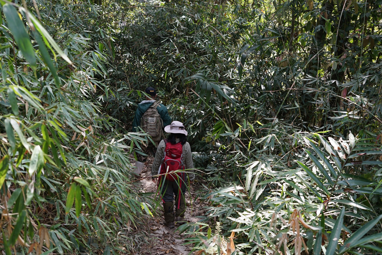
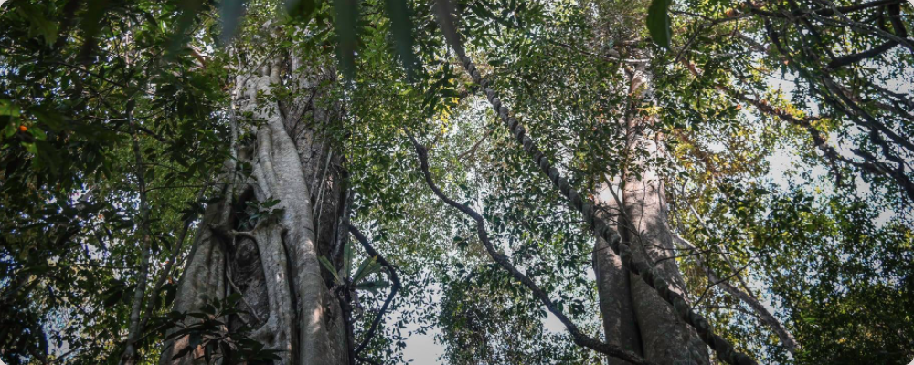
One unmissable activity at Khao Yai National Park is trekking the short nature trails, of which there are seven to choose from. Get ready to study nature!
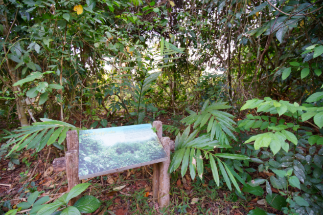
Nature trails in Khao Yai National Park comprise 7 short trails ranging from 1.2 to 8 km And walk times ranging from 45 minutes to 6 hours with no overnight stays on route. Most of the trails have retained their natural aspect and run through mature forest. There are signs along the way to prevent you from leaving the trail. Newbie jungle trekkers and students of nature can walk these trails by themselves.
What is required for trekking in Khao Yai
| 1 | Check the availability of the routes - The 7 nature trails are open at different times. Also, check the weather on the day of the trek. |
| 2 | Study the route, the necessary preparations and the forest trekking code of conduct |
| 3 | Contact the visitor centre at Khao Yai National Park to register and request permission to trek your chosen nature trail. It is not possible to trek alone on some trails, and there is a guide service available for the safety of visitors. |
| 4 | Start trekking the nature trail for which you have been given permission |
*More information : 086-0926529, 081-0639241

Note
Trails 1-5 and 7 can be started between 8 a.m. and 2 p.m.
Trail 6 must be started not later than 10 a.m.
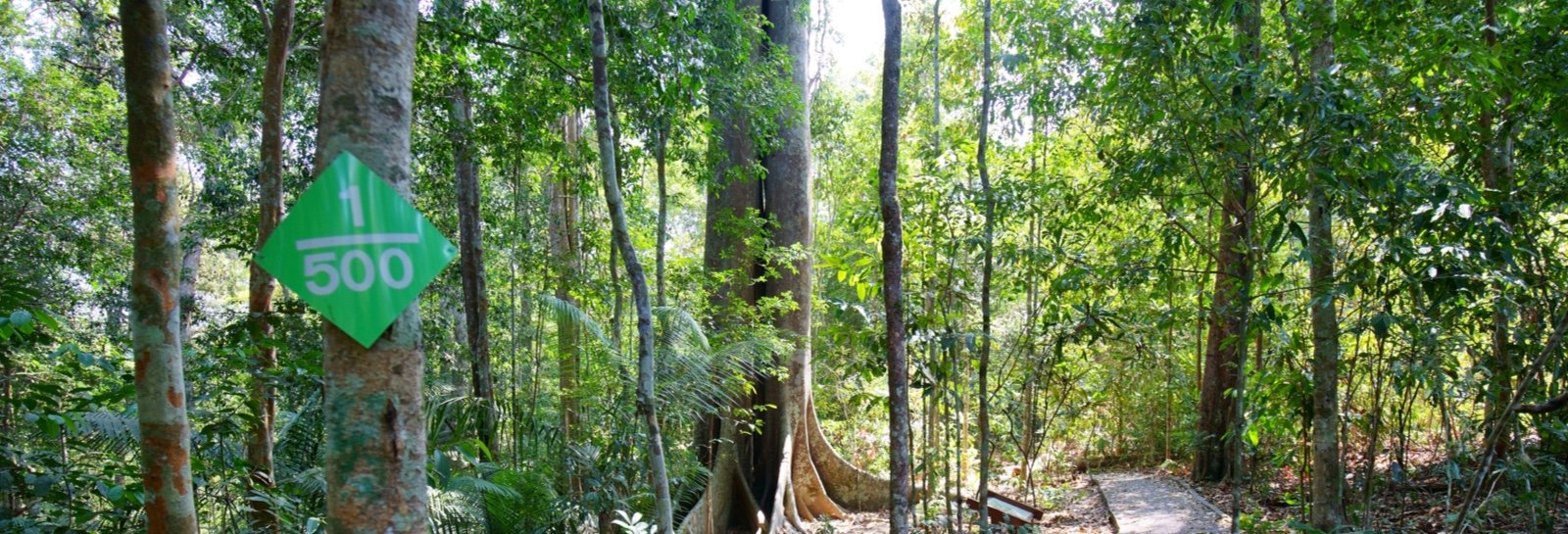
 | Nature trail signs to prevent you leaving the trail |
Top number: The number of the trail, e.g. Trail No. 2
Bottom number: Distance in metres e.g. 300 metres
Trail
Trail No.
1
1
1200
Visitor Center – Kong Kaew Waterfall
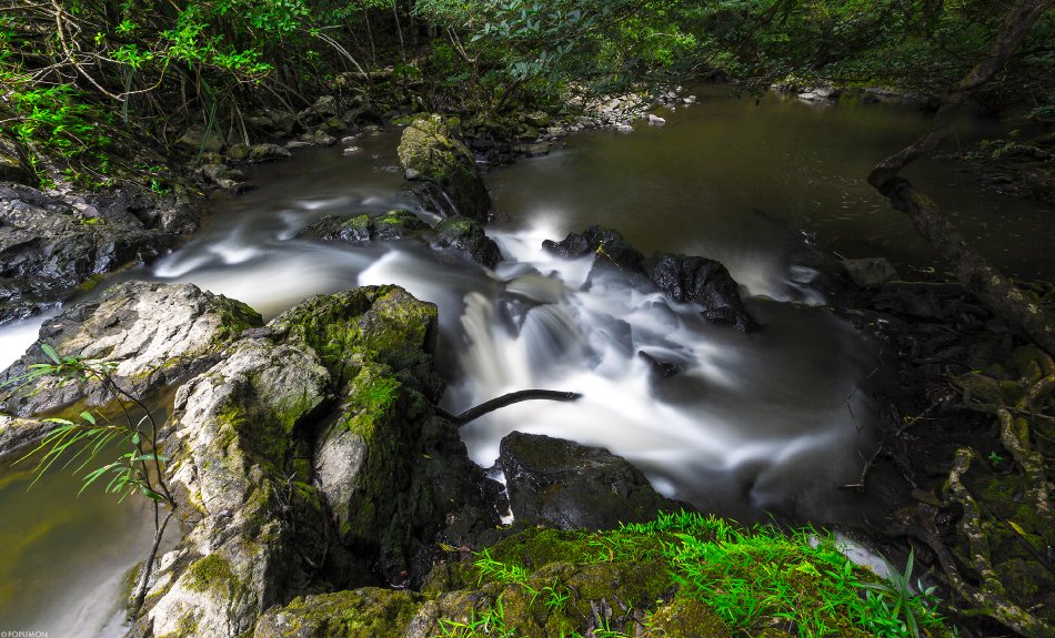
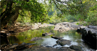
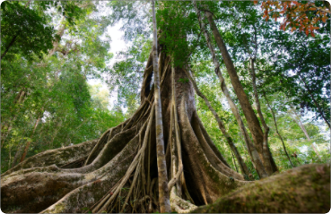
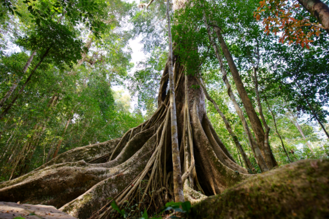
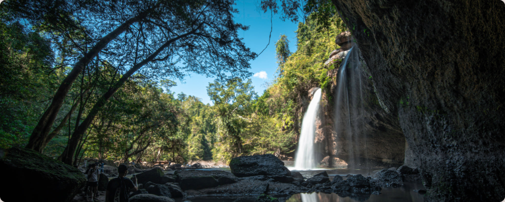
This is the shortest nature trail and the easiest to trek. It is suitable for visitors of all ages. It skirts rainforest alternating with dry forest in excellent condition. All along the trail is valuable agarwood with the refreshing scent of a fire. Animals encountered might include the Lar gibbon, pileated gibbon and various birds. At the end of the trail is Kong Kaew Waterfall, with the refreshing cool of a forest stream from volcanic rock and freshwater swamp forest, both photogenic and educational.

Distance: 1.2 km – One-way circular trail returning to the start point
Estimated time to trek: 45 mins - 1 hour
Trail guide : Not necessary
Start point: Hanging bridge behind the Visitor Center
End point: Hanging bridge behind the Visitor Center at the National Park Office
Open all year
Trail No.
2
2
3000
Pha Kluai Mai Campground – Haew Suwat Waterfall (160 th Anniversary Thai - German Friendship Triail)
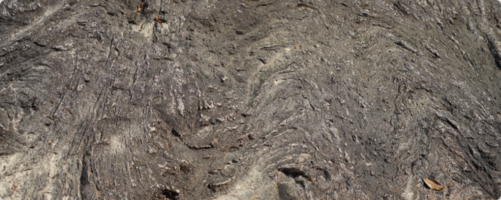
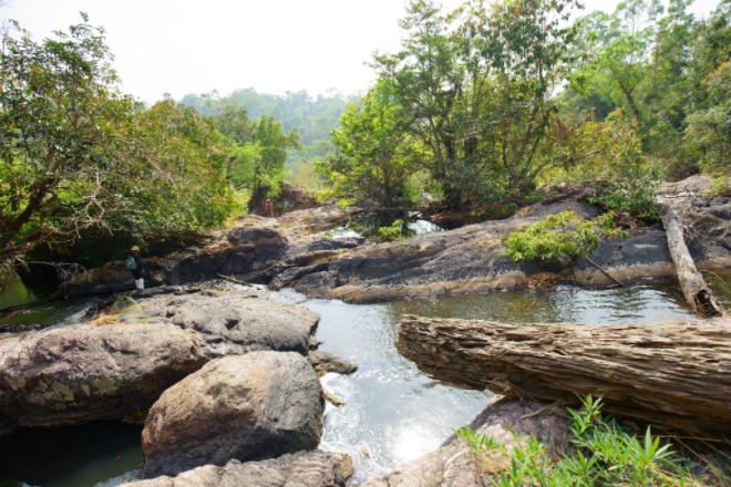
This nature trail links two waterfalls, following Lam Ta Khong stream and alternating between bamboo forest and dry forest at intervals. Along the trail you will hear the thundering sound of Pha Kluay Mai Waterfall during the rainy season. However, when water levels drop in the dry season, you can see the traces of lava flow from a volcano hundreds of millions of years ago. Also there are Polypleurum flowers, a newly reported species, sprouting between the rocks, along with Renanthera orchids (“Whai Daeng”), which give the waterfall its name from the white and red blooms appearing around the waterfall during April.
Many species of animal can be found near the water course such as butterflies, water dragons and otters, with groups of gibbons in the trees, hornbills and hawks foraging for food. At the end of the trial are rock platforms in the stream which are only visible during the dry season.
Distance: 3 km one-way trail
Time taken: 2 hours
Trail guide : Not necessary
Start point: Pha Kluai Mai Campground
End point: Haew Suwat Waterfall
Open all year
Trail No.
3
3
4200
Km. 33 – Nong Phak Chi (90 th Anniversary Thai - Switzerland Friendship Triail)
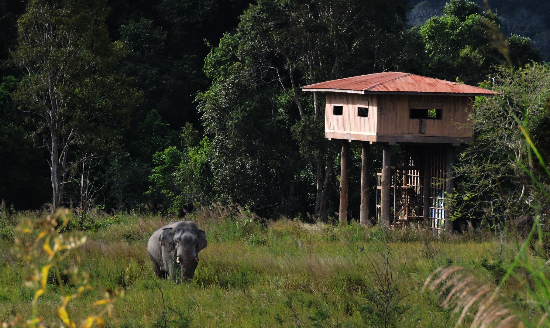
This nature trail highlights a variety of different forest types – mature dry forest, secondary forest and grassland. The trail is shaded by tall trees throughout its length such as banyan and java plum. Their delicious fruits attract many birds and animals to make a “restaurant for wildlife”. There are giant basil trees which are unique to the Dong Phaya Yen complex. It is also a foraging trail for elephants and gaur, so you may come across their tracks or dung. You might see a pair of hornbills making a nest in a tree hollow, or gibbons swinging around gathering fruit. When you arrive at the Nong Phak Chi Observation Tower, you can see many kinds of animals near the water sources and salt licks in the grass such as elephants, gaur, gibbons and hornbills.
Distance: 4.2 km one-way trail
Time taken: 2.5 - 3 hours
Trail guide: Mandated
Start point: At the roadside by the Km. 33 milestone
End point: At the roadside by the Km. 35 milestone, about 1 km from the Observation Tower
Open all year
Trail No.
4
4
2700
Dong Tiw – Sai Sorn Reservoir
This one-way trail leads to Sai Sorn Reservoir, a beautiful spot to watch the sunset. The trail goes through dry and secondary forest which is the habitat of the Lar gibbon. The rainy season brings out a beautiful array of flowers such as balloon plant, begonia and mossiata. The highlight is a giant Biang tree which is centuries old. The secondary forest is relatively open with the chance to see many birds such as blue-eared barbet, stripe-throated bulbul, black crested bulbul and green-billed malkoha.
Distance: 2.7 km. one-way trail
Time taken 1.5 - 2 hours
Trail guide: Mandated
Start point: At the side of Thanarat Road about 200m from the Visitor Center at Sai Sorn Reservoir.
End point: Sai Sorn Reservoir
Open all year
Trail No.
5
5
5500
Dong Tiw – Nong Phak Chi
This trail starts in the same place as Trail No. 4. It is a nature study trail encountering a diversity of forest types such as mature dry forest, secondary forest and grassland, and alternates between a flat basin and steep paths up and down hills. The highlight of this trail is a giant Baing tree which is centuries old. In the rainy season you may see wild mushrooms in bizarre shapes and bright colours. This trail is a foraging ground for many animals such as elephants, bears, hornbills and gibbons. The last portion of the trail leads to Nong Phak Chi Observation Tower where you can watch animals large and small coming out to feed by the water in the grassland, and may encounter elephants, gaur, gibbons, hornbills among many others.
Distance: 5.5 km. one-way trail
Time taken: 3 hours
Trail guide: Mandated
Start point: At the side of Thanarat Road about 200m from the Visitor Center at Sai Sorn Reservoir.
End point: At the roadside by the Km. 35 milestone, about 1 km from Nong Phak Chi Observation Tower
*Caution: During the rainy season, it might not be possible to cross the Lam Ta Khlong stream.
Open all year
Trail No.
6
6
8000
Visitor Center - Haew Suwat Waterfall
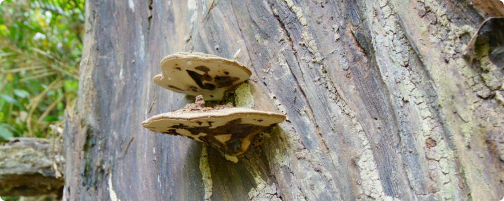
This nature trail is a big nature lesson and a rather long distance. The forest on the way is both rain forest and dry forest interspersed with bamboo groves. Many plants to see on the way include Siamese rosewood and scented agarwood. There are also dense thickets of large ferns and abundant animals such as elephants, gibbons, Asian black bears and hornbills. It is a challenging trail with many twists and turns, and a foraging trail for wild elephants, so the route may be confusing, and this is why it is necessary to have an experienced trail guide.
Distance: 8 km. one-way trail
Time taken: 6 hours
Trail guide: Mandatory
Start point: Hanging bridge behind the Visitor Center
End point: Haew Suwat Waterfall
*Caution: This trail should be started before 10.00. Prepare a packed lunch

Trail closed: 1 July - 31 August
Trail No.
7
7
2000
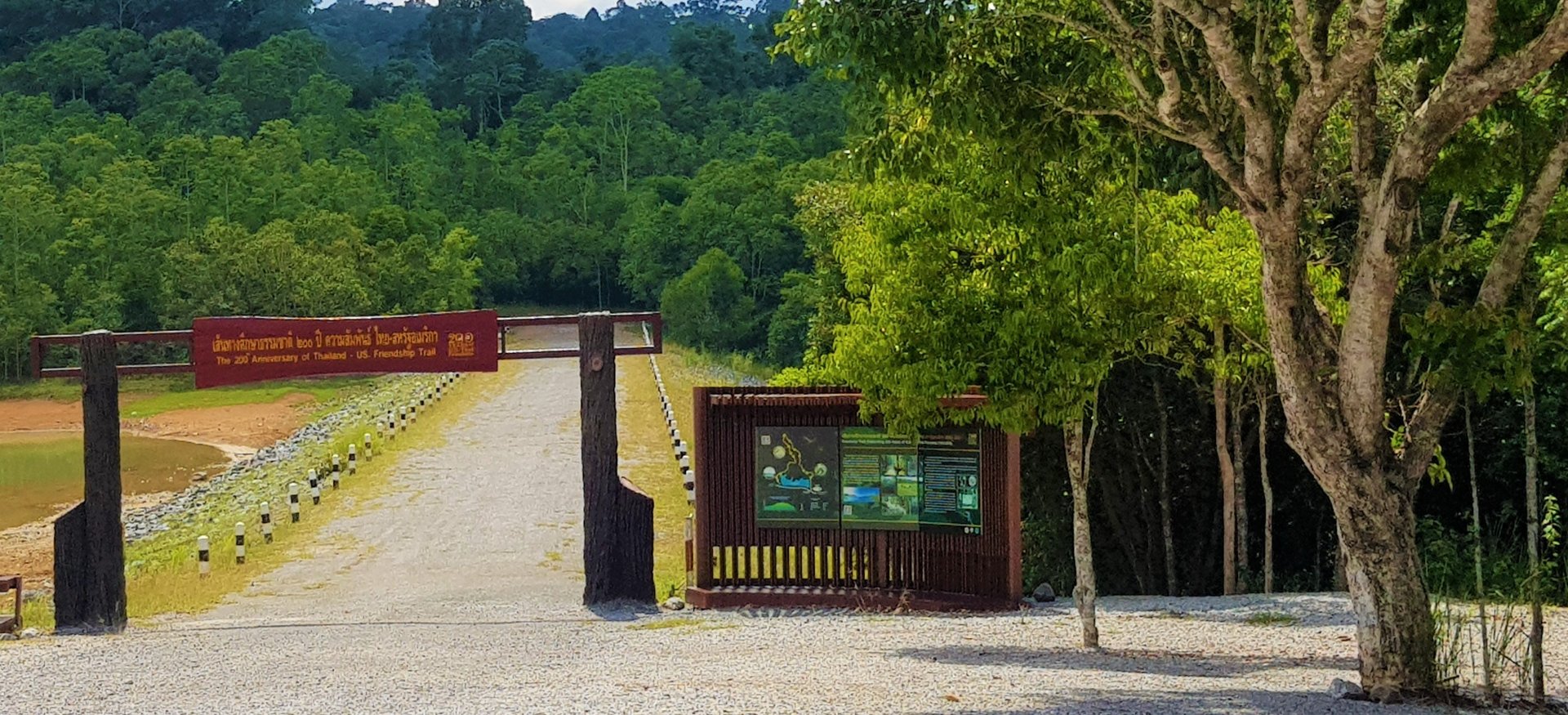
Thai-American Friendship Trail
Khao Yai National Park’s latest trail celebrates the long and friendly relations between Thailand and the USA. Besides having markers of the historic relationship, the trail also follows the standards of the USA’s national parks through the Sister Parks Arrangement for Resources and Knowledge Sharing (SPARK). The trail takes in different ecological zones such as dry forest, secondary forest and grassland. Frequently encountered wildlife include the Siamese Fireback, silver pheasant, gibbons and hornbills
Distance: 2 km. one-way circular trail returning to its starting point
Time taken: 1.5 hours
Trail guide necessary?: No
Start point: Ridge of Sai Sorn Reservoir
End point: End of Sai Sorn Reservoir
Open all year

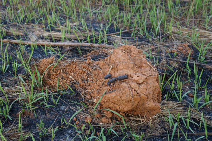
Guess which animal made these tracks?
While trekking a nature trail, you shouldn’t miss looking for animal tracks of the resident fauna. It is an activity of discovery, even if we don’t see the animal directly, and coming across the bigger animals is rare indeed. In actual fact, we are the strange object to the animals, and their instincts are naturally cautious. They generally conceal themselves, leaving only their tracks for us to decode.

Deer
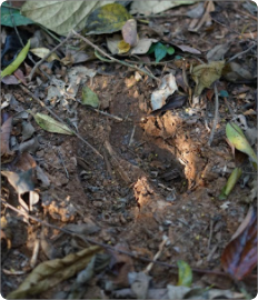
Answer:
Gaur tracks
We can distinguish animals by their footprints, whether they are hoofed animals or a predator.

Gaur
Gaur
Answer:
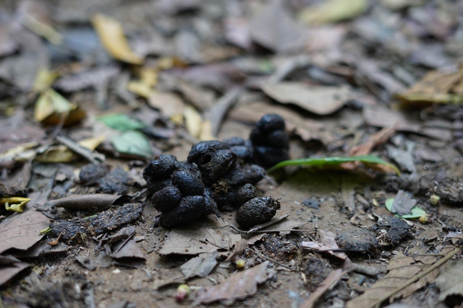
Palm civet droppings
Droppings left in the forest tell us which animal is foraging nearby.
Palm civet